The
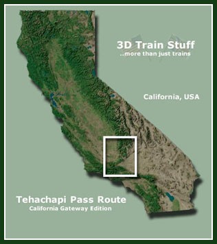
Tehachapi Pass Route II - California
Gateway Edition is an add-on route
for Microsoft Train Simulator, developed
inhouse, and includes the world famous
"Tehachapi Loop" at Walong.
The add-on features over 100 Miles of
accurate route covering two different railroad
subdivisions, and two branchline operations.
The
Southern Pacific railroad originally built
the line over the Tehachapi Mountains
back in the late 1800s in order to gain
access into Los Angeles and the greater
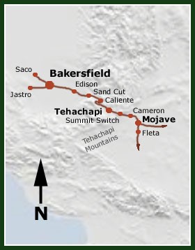
southern california area. The mainline
makes a climb of nearly 4,000 feet in
elevation between Bakersfield which is
at 600 feet, and Summit Switch located
east of the small town of Tehachapi which
is at 4,600 feet. The line then descends
down the eastern side of the Tehachapi
Mountain range, and into the small high
desert community of Mojave.

To
see more maps and screenshots CLICK
HERE
|

Ruling
grades over the pass roughly range between
2.4 and 2.8 percent. The steep mountainous
grades, and countless mountain curves
present quite a challenge to man and machine,
and the route is still considered be one
of the most challenging for crews in the
USA.
Our
version of this route was developed to
represent the more modern 90s era of the
line, and includes operations of the Union
Pacific and Southern Pacific (SP merged
with the UP in the 90s), BNSF, and SJVRR.
And we also included South Bakersfield,
Oil Jct., and the Arvin Branch, all of
which are now serviced by the SJVRR.
Helper
service runs on both sides of the pass,
from Mojave to Summit Switch on westward
trains, and Edison to Summit Switch on
eastward trains. Also, the helpers are
usually cut in mid train or put on the
rear of the train so they can shove. Its
also interesting to note that nowadays
they will leave locomotives on the rear
of a train in order to assist with dynamic
braking while descending the hill.
|
Price:
$32.15 (USD) available for download only
buy
it now

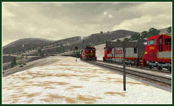
TWO
SANTA FE TRAINS MEET AT MARCEL ON A COLD WINTER
MORNING IN THE TEHACHAPI'S
The
route features over 100 miles of prototypical
mainline and branchline operations, and is completely
developed with accurate scenery. We even included
35 square miles in and around the Bakersfield,
CA area, and the Arvin Branch! So here is what
we included:
|
 100
Miles of route covering 2
Subdivisions, and 2 branches 100
Miles of route covering 2
Subdivisions, and 2 branches
 Accurate
scenery over the entire route, including
lots of people, and animated objects! Accurate
scenery over the entire route, including
lots of people, and animated objects!
 18
Activities covering SJVRR, BNSF, UP,
and SP operations between Mojave and
West Bakersfield. to take a peek at
the activity work orders click
here 18
Activities covering SJVRR, BNSF, UP,
and SP operations between Mojave and
West Bakersfield. to take a peek at
the activity work orders click
here
 Three
Freight Yards, BNSF Bakersfield UP-SP
Bakersfield - SP Mojave Three
Freight Yards, BNSF Bakersfield UP-SP
Bakersfield - SP Mojave
 Arvin
Branch (for SJVRR operations) Arvin
Branch (for SJVRR operations)
 Bakersfield
Amtrak, and UP-SP Stations Bakersfield
Amtrak, and UP-SP Stations
 Bakersfield
BNSF Office Bakersfield
BNSF Office
 San
Joaquin Valley RR #1754 GP9 (low nose) San
Joaquin Valley RR #1754 GP9 (low nose)
 Kern
Jct. and the line out to South Bakersfield Kern
Jct. and the line out to South Bakersfield
|
 Dole
Piggy Back Cars Dole
Piggy Back Cars
 TankTrain
- GATX trainsets TankTrain
- GATX trainsets
 Union
Pacific SD70Ms Union
Pacific SD70Ms
 Southern
Pacific SD70Ms Southern
Pacific SD70Ms
 Southern
Pacific GP20s Southern
Pacific GP20s
 Santa
Fe SD75Ms Santa
Fe SD75Ms
 Santa
Fe GP20s Santa
Fe GP20s
 Santa
Fe F45 (AI only) Santa
Fe F45 (AI only)
 BNSF
666 - Amtrak 801 - CSX 52 BNSF
666 - Amtrak 801 - CSX 52
Dash 9 44CW Skins
 Tehachapi
Manual (Word document with
photos) Tehachapi
Manual (Word document with
photos)
|
Price:
$32.15 (USD) available for download only
buy
it now

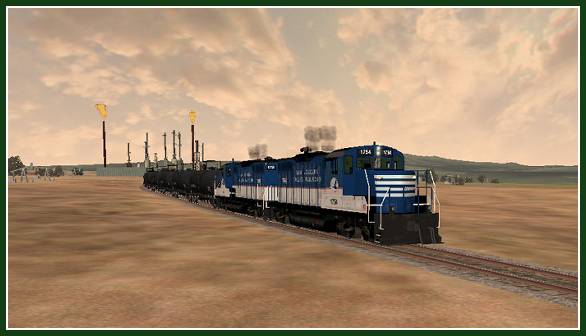
SJVRR
1754 WORKING SOME TANK CARS AT ONE OF THE REFINERIES
NORTHWEST OF BAKERSFIELD
we
also included 18 activities for your enjoyment,
some of which that are either preludes or sequels
to some of the Cajon Pass activities included
in our other great add-on, The
Cajon Pass Route - High Desert Rails Edition.
To see some of our work orders that you can print
out, click
here.
Tehachapi
Pass Route II Screenshot Galleries
|